Collect
and edit
data.
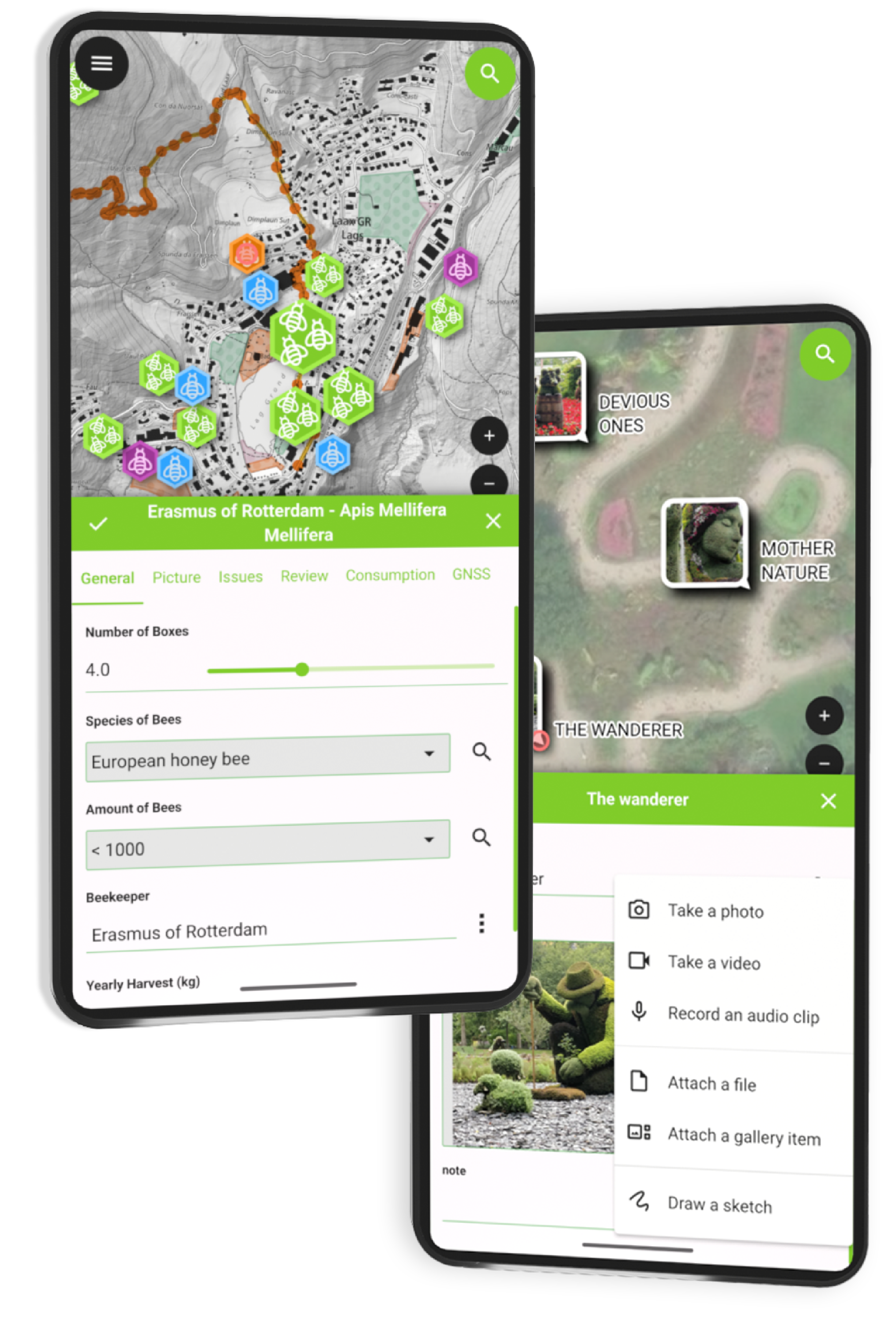
Synchronise
and
collaborate.
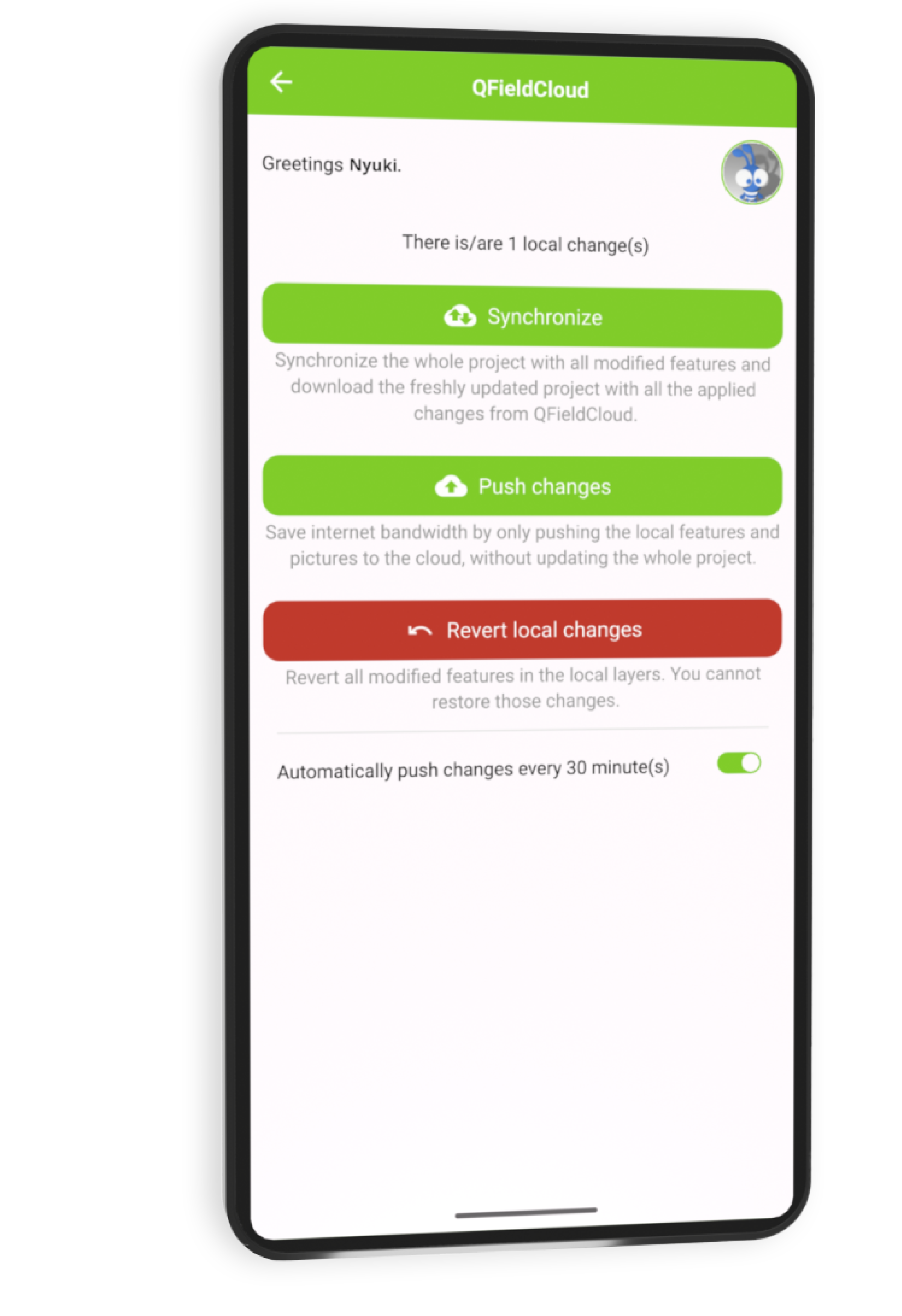
Customise
with your
plugins.
QField maps everything that matters to you
Fast, reliable, multilingual and open-source, QField brings the power of QGIS wherever your work takes you.
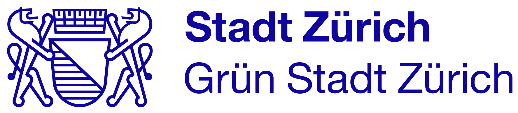
Smart maps
High precision location, tracking, geofencing, and full QGIS symbology, just like on desktop.
Powerful Forms
Create rich survey forms with constraints, logic, defaults, and validations — all in QGIS.
Capture everything
Photos, videos, audio, QR code scanning, and NFC — fully integrated.
Seamless sync & format support
Sync projects and data in real time with QFieldCloud and work with GeoPackages, KML, GPX, georeferenced PDFs, and more.
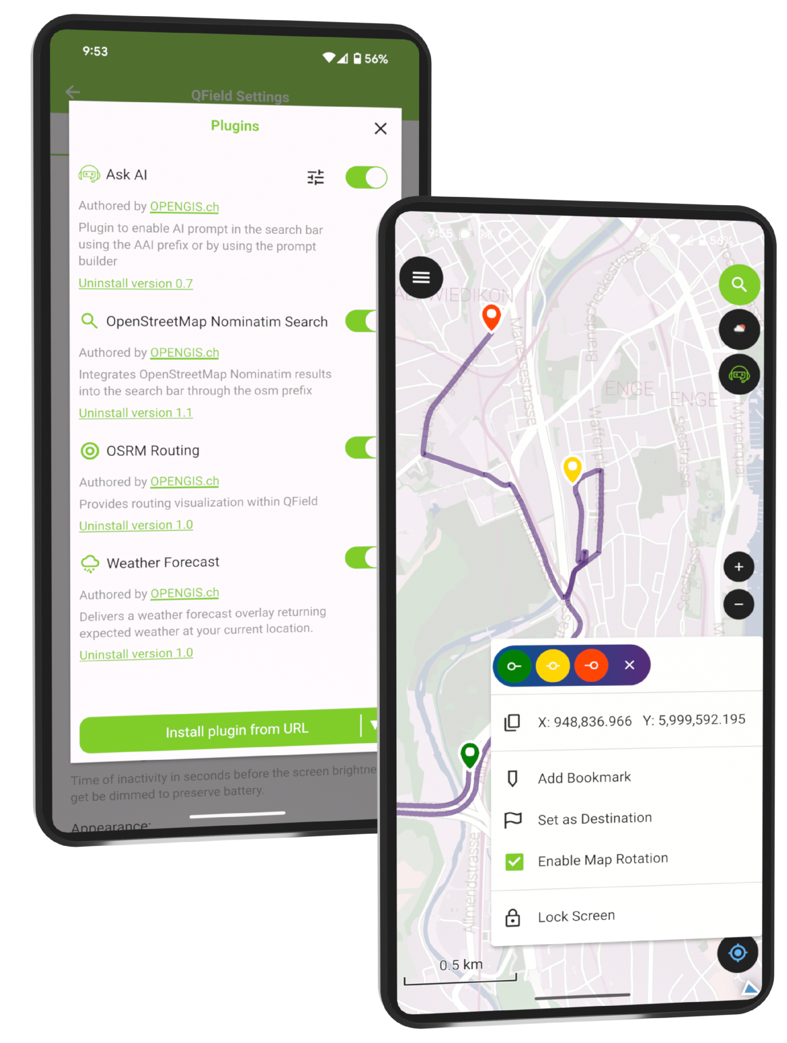
Editing & processing tools
Snap, reshape, freehand draw, edit vertices, and run field-based geometry operations.
Plugin support
Extend QField with custom QML/JavaScript tools and workflows.
And what data do you care about?
Let QField help you bring it to life. Accurately, efficiently, and anywhere it matters.
Get started now!
QField Success Stories


National Land Survey of Finland
QField lets our field staff work smarter and faster, even in the most remote corners of Finland. It's a vital part of our open-source geospatial infrastructure.
Jani Kylmäaho, Chief Digital Officer NLS
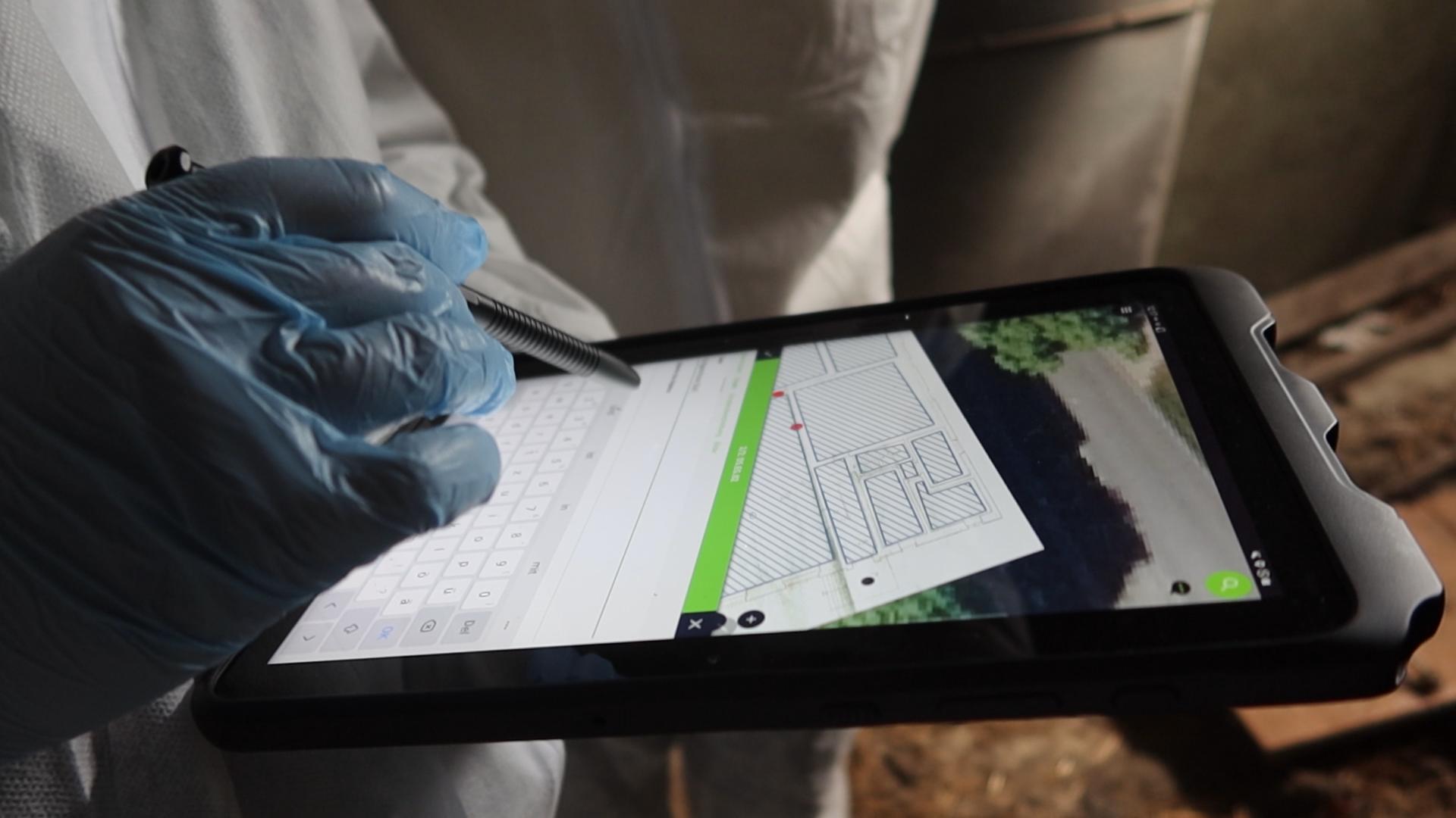
Read more...German Archaeological Institute
The KulturGutRetter project (Cultural Heritage Response Unit) has successfully completed its latest field tests, demonstrating the effectiveness of its innovative approach to the emergency rescue of cultural heritage. Utilizing cutting-edge data acquisition and management techniques, Kulturgutretter is leading the way in preserving invaluable cultural treasures and to safeguard heritage for future generations.
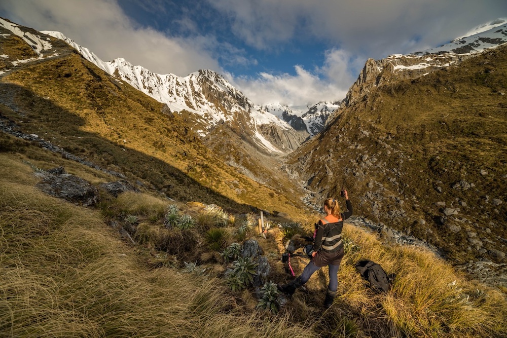
Read more...Zero Invasive Species
In the rugged wilderness of New Zealand's South Westland, an ambitious conservation project is underway. Zero Invasive Predators (ZIP) is systematically eliminating possums, rats, and stoats from vast tracts of forest—with QField and QFieldCloud playing a crucial role in their operations.
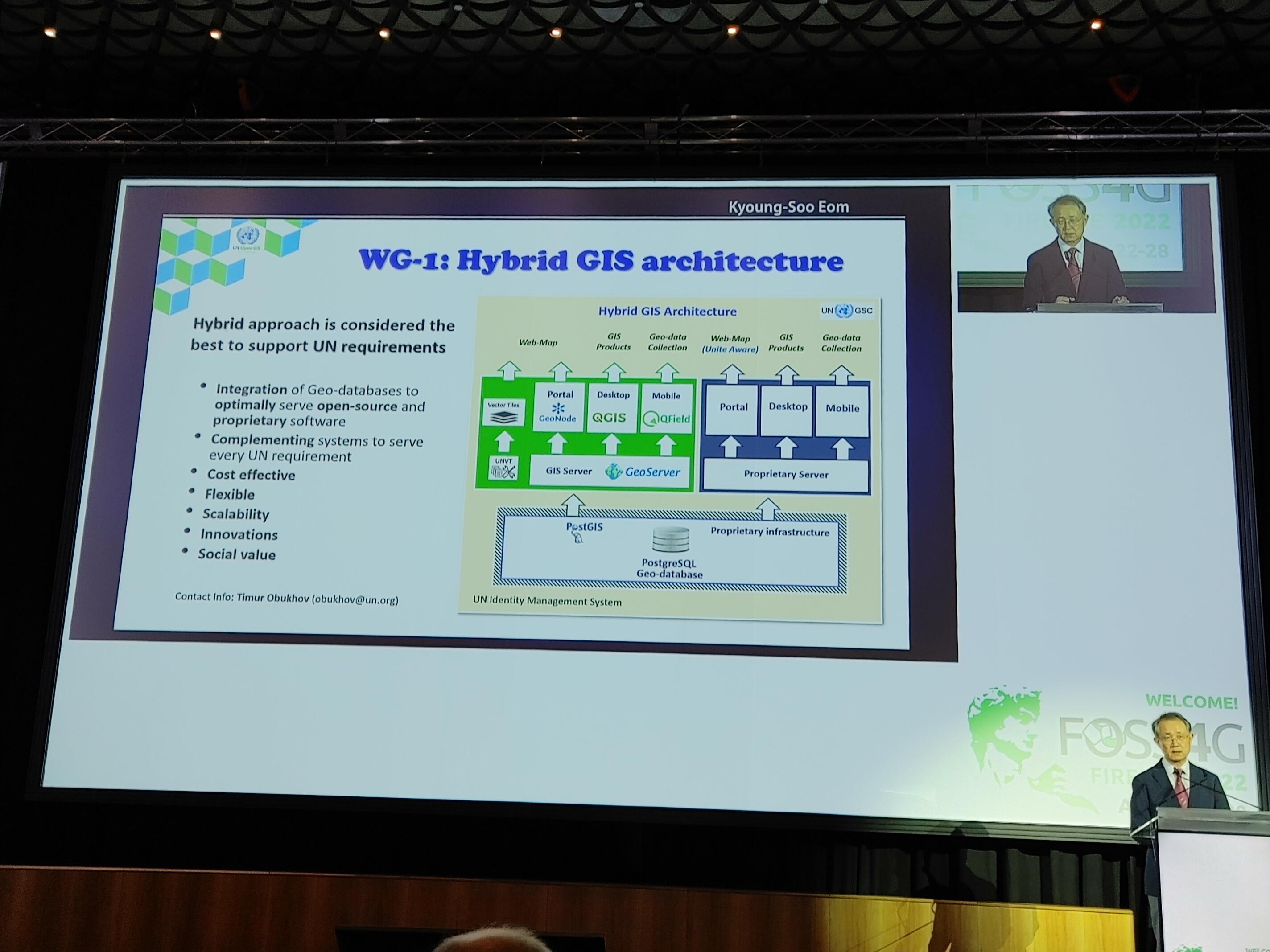
Read more...UN Open GIS Initiative
QField has been spotlighted by the UN OpenGIS initiative as a crucial part of their hybrid GIS system. This recognition underscores QField's superior capabilities in supporting multiple United Nations Sustainable Development Goals (SDGs) and revolutionizing geospatial data collection.
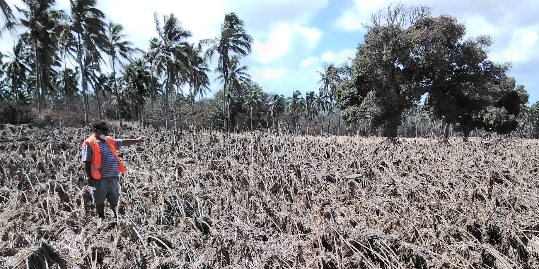
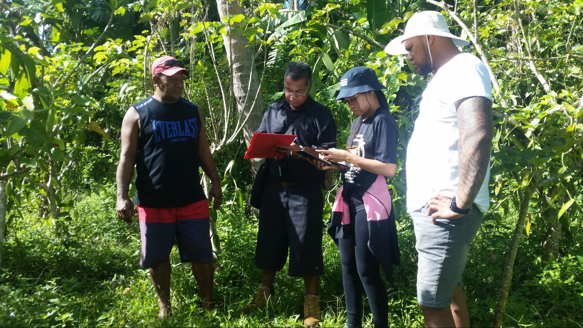
Read more...Ministry of Agriculture & Food, Forests and Fisheries of Tonga
In January 2022 the Hunga Tonga-Hunga Ha'apai submarine volcano erupted. Ash clouds from the eruption and the subsequent tsunami damaged croplands on the Tongatapu and Ha'apai island groups. The internet cable to Tonga was severed during the eruption. In particular, QField was used to generate maps of where fields had been cleared and re-ploughed using government support.
Read more...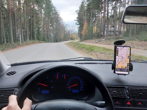
QField makes a difference
Dive into success stories from the field, sorted by industry:


Trusted by